What's It All About, eh?

Cape Breton evokes deep memories and strong emotions for me as well as a deep appreciation for the beauty of my adopted island. My hopes are that you too might find the photos evocative - maybe a view you've not enjoyed before, or an 'Oh I've been there', or if from away that you may be encouraged to visit this fair isle so that you might come to love and breathe Cape Breton as I do. One word about place names that I use - some are completely local usage while others are from maps of Cape Breton that I've purchased over the years. I frequently post travel and other photos that are of interest to me - and hopefully you.

On the right hand side bar find my take on Single Malt whiskey - from how to best enjoy this noble drink to reviews (in a most non-professional manner) of ones that I have tried and liked - or not. Also musings, mine and others, on life in general.

Photographs are roughly 98%+ my own and copy-righted. For the occasional photo that is borrowed, credit is given where possible - recently I have started posting unusual net photographs that seem unique. Feel free to borrow any of my photos for non-commercial use, otherwise contact me. Starting late in 2013 I have tried to be consistent in identifying my photographs using ©smck on all out of camera photos I personally captured - (I often do minor computer changes such as 'crop' or 'shadow' etc but usually nothing major), and using
©norvellhimself on all photos that I have played around with in case it might not be obvious. Lately I have dropped the ©smck and have watermarked them with the blog name.

COMMENTS are appreciated as feedback is the driving energy of blogging - And if you like this site please pass it along to a friend. Thanks!

NOTE: TO ENLARGE PHOTO, CLICK ON SAME - If using Firefox also click f11 - photos will fill the screen ...... ----------------------------------- ......TRANSLATION BUTTON AT TOP OF LEFT COLUMN!
26 October 2013     photo by earthling smck
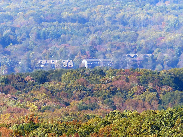
 - and from below, in all that forested land seen from above, it looks like this -

Bay View

26 October 2013       photo by smck©
The 'Bay View' of the title is the name of a long existing little community several miles north of North East - in this photo barely visible as a light smudge at the center top of the distant hills - and is so named because some early homes there when farming had cleared many of the trees had views of the Chesapeake Bay from a couple well chosen locations.

Elk River


26 October 2013     photo by smck©
This is a view of Elk River in the distance - Once I learn how to adjust focus manually I think I can get a more detailed photo of the sailboats etc there.


Looking toward Havre de Grace

26 October 2013      photos by smck©

In this view of the head of the Chesapeake Bay the Susquehanna River, beyond the neck of land protruding from the right, is flowing from the left past the town of Havre de Grace while the closer water this side of the neck is the Northeast River (a little known bit of trivia is that at one time the Northeast was planned to be called The Shannon).  As you can see by the photos the forest cover is still predominantly green but autumn is bringing in the reds and yellows slowly on Maples, Gum, and Sumac - for whatever reason most of the Oak though losing a fair amount of leafage is losing it in brown leaves - probably from attrition due to lack of rain.  The smallish cove from the Northeast side above is known as Cara Cove (and on some older maps as 'Carrot Cove).

North East Isles

26 October 2013       photo by smck©
 On the out-skirts of the small town of North East is a new (relatively speaking) community called North East Isles located at what I knew of as a kid as "out to the Arundel" and where my father as a young man worked as a laborer loading railroad cars with gravel dredged from the Northeast River.  The gravel cars road on a large trestle track that extended a hundred feet or more into the river so that the barged material could be off loaded.  Here I and other kids would go to dive off the then unused  loading pier and swim in the fairly deep waters.  No road led in there for a long time and one walked the main railroad track to the work switch to the river.  My father always warned me never to go there both because of the danger of drowning trapped in underwater coils of rusting cable and because this was a hang-out for boozing neer-do-wells but all we ever saw was the odd fisherman casting from the shore and giving us annoying looks for scaring away the fish.  In the photo above the condominiums are facing directly into the river which is screened from view here by the forest of tree tops on the Elk Neck Peninsula.